
The Relationship view lets you easily visualize the different entities, the relationships that unite each of them and the ecosystem that revolves around them.
----CONTENTS----
The different types of entities in the Relationship view
Data interpretation (entities and relationships)
Choosing the number of entities to display
Positioning entities on the map
Highlighting an entity's ecosystem
The different types of relationships
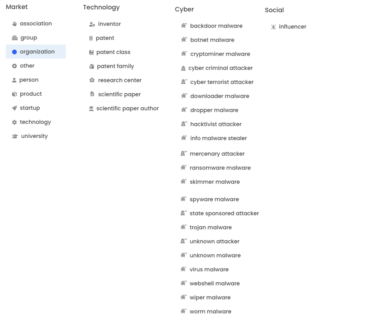
The different types of entities
The purpose of this view is to materialize the ecosystem of your research area by highlighting the entities present in the documents, such as start-ups, universities, public bodies, products, etc. related to this area.
According to connectors,
Data interpretation (entities and relationships)

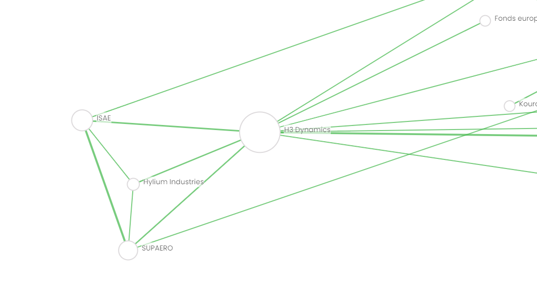
The size of the bubbles and the thickness of the relationships depend on the number of relationships detected with the entity or entities in question.
Number of entities to display
By default, the number of entities displayed is 50, i.e. the 50 entities with the most relationships.

You can increase or decrease the number of entities displayed between 5 and 1000 by selecting the option at the bottom left of this view.
Entity position
When you launch your search, the entities are automatically positioned to give you an optimized view of the information. At the end of this positioning, you can move the entities as you wish in the "Relationships" view. If you want to return to the initial position, you can press the "Reset Layout" button at the bottom left of your screen. The graphic will take a few seconds to reposition itself.
Highlighting an entity's ecosystem
When hovering over an entity or relationship, Geotrend will highlight its direct ecosystem, making it easier to appreciate key information and related interactions.
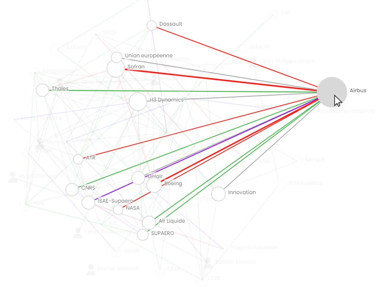
The bubble size of each entity varies according to its media presence on the open web and in relation to the subject of your search. A large bubble size means a high media profile in the ecosyste
The different types of relationship
The different types of relationship between entities allow you to quickly analyze the ecosystem of your search.
The types of relationship depend on the articles collected by Geotrend's Artificial Intelligence, and enable you to apprehend connections between markets, interactions between entities... The thickness of a relationship gives you an indication of its media weight.
A recent partnership focused on a specific field will be presented as weaker than a more established one, for example.
The nature of the relationship is indicated by a shade of color, and you can filter on each one using the Relationship filter.
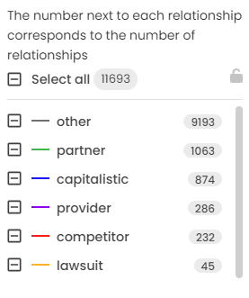
The number in front of each relationship expresses the number of relationships detected in the documents. This is the only filter that does this. For all other filters, the number corresponds to the number of documents.
Here I have 1063 partnership relationships detected in all my documents.
Delete an entity
The body of a search can be modified by its owner. Only the owner can access this function.
He can, for example, delete one or more actors, if they are deemed irrelevant to the current analysis.
To do so, simply
1) select the cross in the functionalities panel on the right of your screen.

2) select the entity or entities you wish to delete on your map.
As you select them, they will be displayed so that you can check your selection before deleting them. Once validated, click on 
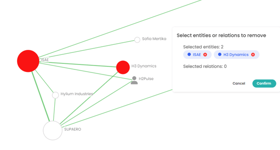
NB: all deletions are final, and cannot be undone unless you restart your search. In this case, the actor will be identified again in the articles and repositioned in your cartography.
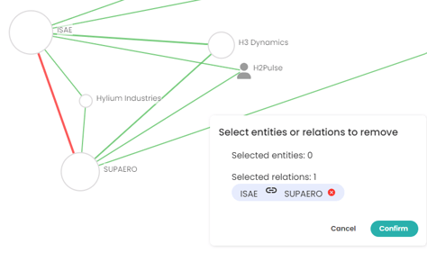
Deleting a relationship
Note that you can also delete a relationship between two entities by proceeding in the same way as above, then selecting the relationships you wish to delete.
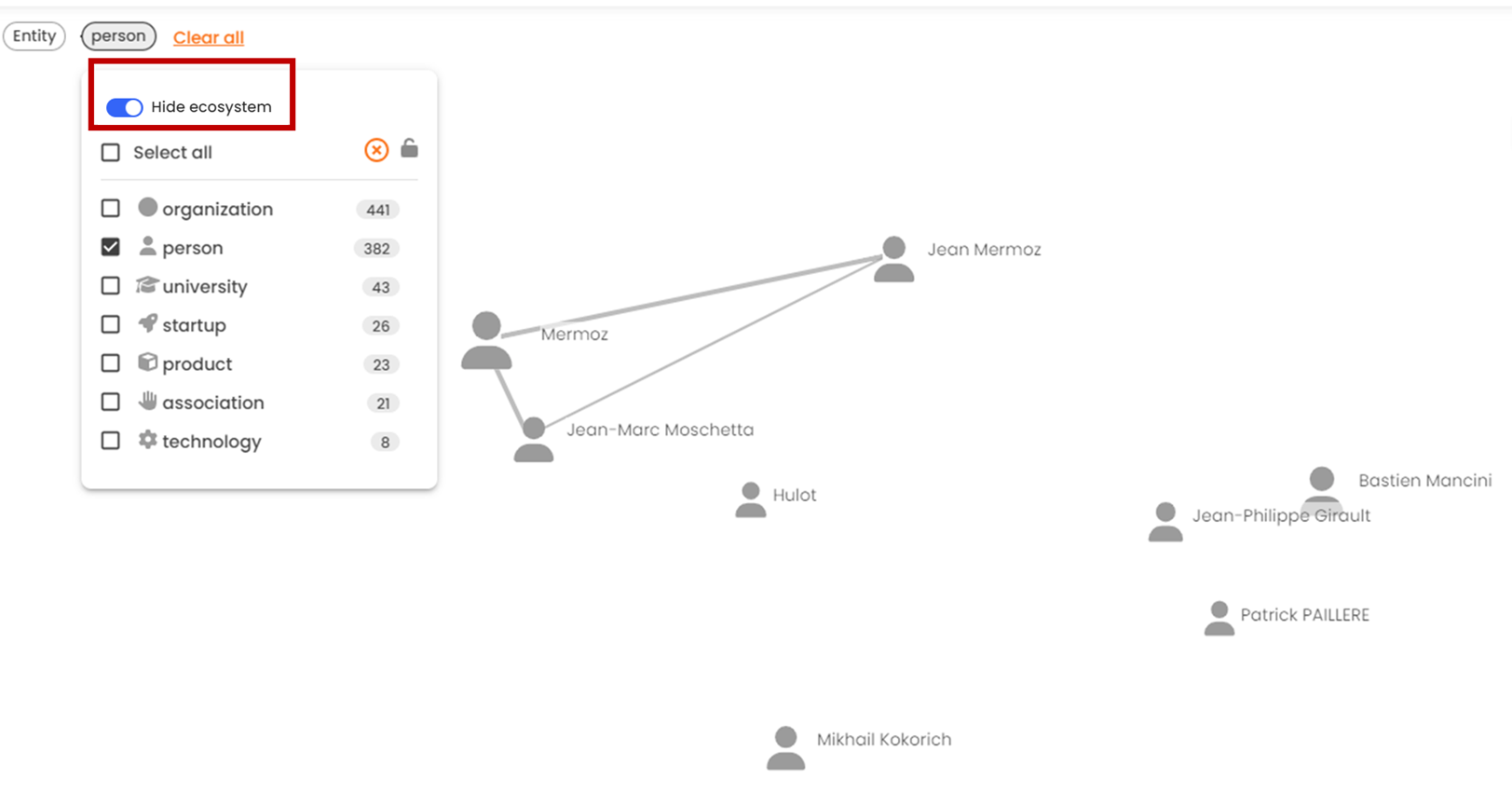
Hide ecosytem (strict filter)
Only applies to "Entity" and "Type of entity" filters
When you select elements from one of these two filters, other information may appear in addition to that selected.
For example: I want to display public persons on my map. By default, Geotrend will not only display people, but also the ecosystem that revolves around them. So my cartography will include public people, but potentially also universities, groups, etc.
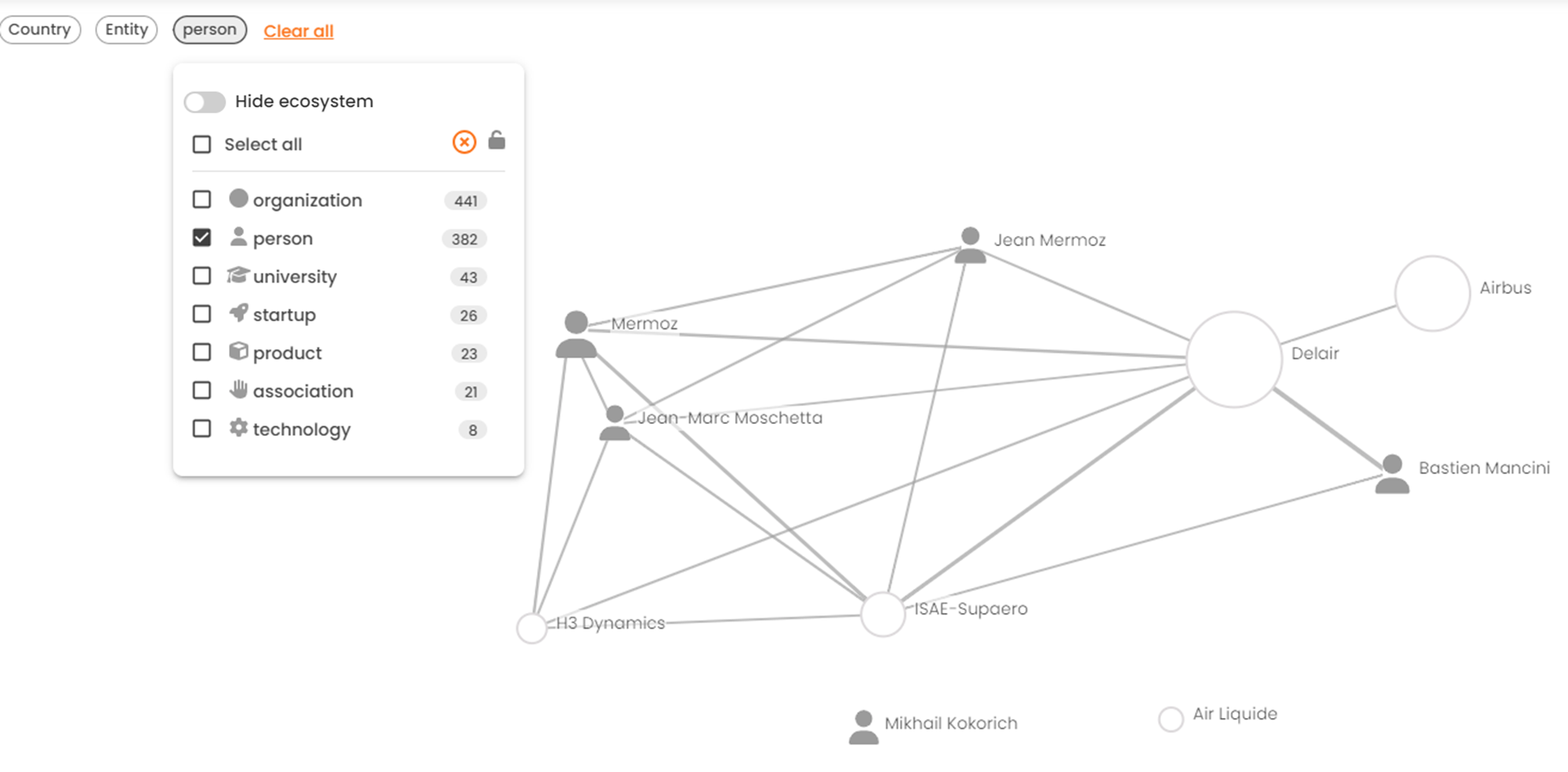
To display only one type of entity or only selected entities without their ecosystems, use the "Hide ecosytem" mode.
Export Relationship View data

Data displayed on the screen can be exported for use in newsletters, presentations, etc.
In this view, you can export data in spreadsheet format (CSV or XLSX) or in visual format (PNG or SVG).
To find out more about exports, read the following article "Export the results of a search"